Showing posts with label ak. Show all posts

Sunday, October 4, 2015

The End ----

I've reached the end of our trip to a small corner of our largest state.  The last afternoon we drove back along Turnagain Arm toward Anchorage International Airport and a flight home.    As with the rest of the trip, we had a few surprises as we drove the Seward Highway.

Turnagain Arm
Low Tide

The Seward Highway follows the mountainous coastline.  All along the way we were treated to spectacular views of Cook Inlet, where mammoth sloping mountains abruptly rise precipitously from this four-mile-wide bay.

It was low tide when we stopped at one of the many overlooks.  Turnagain Arm boasts the second highest tides in North America after the Bay of Fundy. These tides, which can reach 40 feet, come in so quickly that they produce a wave known as a bore tide. Adventurous kayakers and surfers have taken to riding the tide as an extreme sport.

One of the nice surprises we were treated to that day is we pulled over at the best place to observe the bore tide about 20 minutes before it came it.   We even saw what we think were Mountain Goats high on the side of the mountains.   We think that is what they were, but they were really too far away to be able to know for sure.   This stop and bore tide was completely unplanned, at least by us.   God may have had this in mind for us all along.

Bore Tide
We hung out with several others waiting on the tide to make it's scheduled appearance.  About 5 minutes before it was to arrive people start exclaiming "there it is!".   The tide wave was high enough that we could see it long before it got to where we were waiting.   As it got closer there was no mistaking it.  

The height of the tide is dependent on the phase of the moon.  We were there for a medium high tide that was still very impressive.   It was fun watching it come in.

A little way down the highway we stopped at another roadside pull off.  There was a pretty little creek that flowed through the woods and emptied over a waterfall into a small pool before flowing into Turnagain Arm.


 We knew we were in a good spot when a group of photographers on a tour came down the hillside to their van.  The group was led by a guide that was obviously taking them to some of the best spots to photograph.

Before we got back to our car we looked out across Turnagain Arm and saw the setting sun was painting the clouds into a pleasant warm tone.  The tour group was pulled over at the bottom of the hill doing the same thing.

Sunset Painting The Clouds


We got in the car and headed toward Anchorage thinking that was the end of the day.   Just a few miles down the road we saw many cars pulled over on the left and people out taking pictures out in Turnagain Arm.  As we pulled over I saw some movement about a dozen yards from the shore.  It was a Harbor Seal swimming close in.   But no one was looking at the Seal.  Instead they were looking and pointing at this.

Beluga Whale Breaching

A pod of white Beluga whales were following the tide up Turnagain Arm.   Photographing these whales was a real challenge.  The Beluga lack a dorsal fin, which made them blend in and hard to spot. They are only above the surface for a few seconds before submerging again after grabbing a quick breath. Dusk was fairly far along and there was little light to work with.  My photographic style must of looked like I was shooting popup targets in an circus arcade.  Back and forth, trying to focus and shoot before the whale was gone. In the end I didn't get a great photo, but we have great memories.
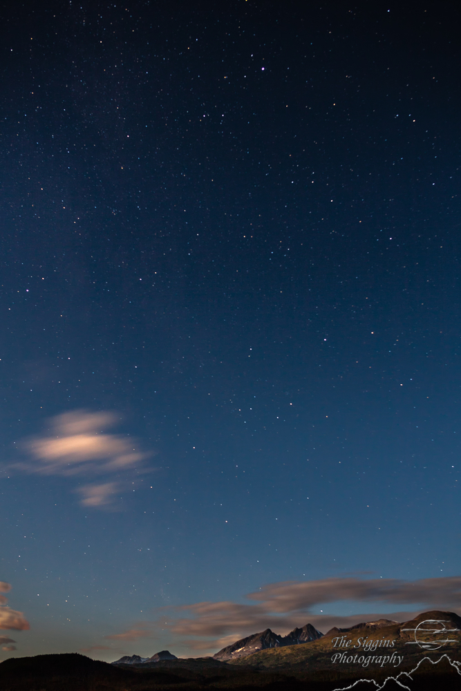

Sunset
Before jumping back in the car I used my long 420mm telephoto lens to shoot down Turnagain Arm to Cooks Inlet, the snow covered Alaska Range and Fire Island.  Fire Island is a 5.5-mile long island near the head of Cook Inlet.  You can see the 11-turbine, 17.6-megawatt wind farm located on the island.  This was the last photo I took on the trip.

We spent 14 days total door to door and only covered a very small area.   If you have stuck with me you have been subjected to 25 blog posts describing what we did on our Alaska vacation.  Even if no one reads these posts, I have enjoyed reliving the trip through photos and stories.   Alaska had been on our bucket list for a while and we wanted to hit it while we can still go on some of the longer more adventurous hikes.  After returning, it's still on our list.  There are many more places to visit and things to do.  We'll be back in a few years.

Thursday, October 1, 2015

Girdwood and Iditarod Trail

On the last night of our vacation we splurged and stayed at the Alyeska luxury resort in the town of Girdwood.   We enjoyed every place we stayed on our journey.  Each one was different from a B&B in someone's home to waterfront cabins and a hillside lodge in Denali.   This night we were going to relax in the saltwater hot tub and enjoy a different kind of accommodations.

The town of Girdwood was originally founded as a supply camp for gold miners with claims along the creeks feeding Turnagain Arm.   It was originally called “Glacier City” for the seven massive glaciers that rim the surrounding mountains.

Seven Glaciers Restaurant
The town had to be moved 2.5 miles after the  1964 Good Friday earthquake, when the land under the original townsite sank into Turnagain Arm, putting much of the town under water.

Today Girdwood is a ski resort and the Hotel Alyeska is at it's center.   Looking out our room window we cold see the tram taking people up to the mountain top to hike, ride mountain bikes down, or eat at the Seven Glaciers Restaurant at the top.


The resort was well landscaped and there were numerous flowers all around the outside of the hotel.  I had a little time and took these two.   The ski lift chairs had water filled blue plastic barrels in the seats to test the mechanisms before winter and the ski season.   The yellow flower was in the sun and the building wall behind it was in deep shade.   Really makes the flower stand out against the black background.

There are several hiking trails and we took the Winner Creek trail.

Winner Creek Trail
While not on hotel property, I think this trail benefits from being very close.   For the first half mile or so the trail was wide, flat and had many boardwalks to protect sensitive plants.   The further from the hotel we went, the less it looked like something from Disneyworld.


At about 2 miles we reached  Winner Creek where this very substantial, yet broken, bridge crossed the creek.  We found that the bridge is there for snowcat drivers to cross in the winter and is not the trail crossing.   That's me in the red jacket taking the photo below.

Snowcat Bridge
Winner Creek from Snow Cat Bridge


Rock in the Creek
I find picking out small parts of a scene can result in some interesting photos.   In this case, I picked out this rock with moss and a couple leaves on it.  The water was streaming around but not over the rock.


The trail joins or is part of the Iditarod National Historic Trail, which commemorates a 2,300-mile system of winter trails that first connected ancient Alaska Native villages.  The Iditarod trail opened up Alaska for the last great American gold rush, and now plays a vital role for travel and recreation in modern day Alaska.

Over 1,500 miles of the historic winter trail system are open today for public use across state and federal lands.  The trail is best known today for its annual Iditarod Sled Dog Race. Race participants and their teams of dogs spend up to 15 days mushing 1,000 miles from Anchorage to Nome.
Iditarod National Historic Trail


At about 3 miles we reached the Winner Creek Hand Tram.  Described as a "very Alaskan way to cross a creek", the tram is basically a metal cage suspended by steel cables across the creek.   One or two people can pull themselves across high above the creek.   We went across and back.  Pulling is harder than it looks.

Winner Creek Hand Tram
 We crossed high above the creek.  Lower down were the remains of earlier trams.
Check out our shadow

This was an easy enjoyable hike and I recommend it.  Most anyone can make it to the hand tram.   The trail continues on to the Crow Creek Mine Road.   We visited the Crow Creek mine later in the day.  More about that in the next post.

Sunday, September 27, 2015

A Couple Days in Seward Alaska

View From Seward Byway


The town of Seward Alaska was about 20 miles down the Seward Highway from our little cabin on Kenai Lake.  We made that trip two or three times.  It's a beautiful drive passing by mountains with hanging glaciers, lakes, streams, and miles and miles of evergreen trees.

Starting in Anchorage, the Seward Highway snakes around the coastline through the Kenai Peninsula for 127 miles.  The highway was designated a National Forest Scenic Byway by the U.S. Forest Service on September 8, 1989. Later, the State of Alaska added it to the State Scenic Byway system on January 29, 1993, when the Seward Highway was named an All-American Road as part of the National Scenic Byway program by the U.S. Secretary of Transportation. This is not a road you take to get to a destination as quickly as possible.  There are numerous interesting places to stop and enjoy along the way.   If you go, take your time and enjoy the ride.   I'll be sharing more sites from the Seward Highway in the next couple posts.

For most of the drive you'll not find the typical tourist businesses along the way.   There are few hotels or restaurants.   Along the highway we ate at the campground restaurant in Moose Pass (population 200) and at the Exit Glacier Salmon Bake.   Despite what their sign says, the Salmon Bake is a great place to stop and eat.

Who could resist this kind of marketing?

It's also an interesting place to take photos.  They had a collection of interesting old stuff outside, including this boat and truck.  I doubt the truck still runs and the bottom of the boat was rotted through, but they make interesting subjects.  

The inside of the restaurant is a collection space for all kinds of interesting old stuff.  No camera shots from the inside.  After climbing the Harding Icefields Trail we were more interested in eating than taking pictures.


We didn't get to see sea life on the planned sea kayaking trip so we did the next best thing and visited the Alaska Sea Life Center in Seward.   Alaska’s only public aquarium and ocean wildlife rescue center is located right on Resurrection Bay.  Inside we were able to have close encounters with puffins, octopus, sea lions and other sea life.


Puffin
The puffins were especially fun for us to watch.  They are comical birds.  One in particular would get in the middle of the pool and swim around and around in circles.   Unfortunately, they were in a glassed in enclosure and the glass was not real clean on their side.  I didn't get many good pictures of them, but we sure did enjoy watching them waddle, swim, and dive deep under the water.  If you are in Seward, take a few hours and visit the center.

On August 30 we took a hike from Seward to Tonsina Creek, a scenic 3 mile trail that takes about 1 hour in each direction.  The trail starts in a camping area about 100 feet above Resurrection Bay. The first half of the trail is wide and pretty much up hill.  There were trees across the trail in several places, having been blown over by the recent high winds.   Our destination was Tonsina Creek that empties into the bay so the second half was all downhill, reclaiming all that elevation we gained in the first half.

Tonsina Creek
Swimming Up Stream
The final decent is over a series of boardwalks placed in a zig zag switchback pattern ending at a foot bridge over Tonsina Creek.  The Seagulls were there because the creek was full of Salmon attempting to swim up stream to spawn where they were born. The photos have an abstract artsy feel.

There were almost as many dead Salmon as there were live ones.  The birds seemed to zero in on a section in the fish's tail, pecking a hole and eating what must be prime eats for Seagulls.


It's A Struggle

It was low tide when we were there and we were able to walk out on what is the bottom or the bay at high tide.  At one point we are walking through a grassy area and came upon a dead Salmon on the trail, left there when the tide went out.
Resurrection Bay
The rhythmic waves in the bay had created ridges in the sand.   They seemed to be reaching for the mountains on the other side of the bay.


Patterns In The Sand
Seward is a destination for cruise ships in Alaska.  There were two in port that day and both left while we were exploring Tonsina Creek area.   Neither ship was huge.  I doubt the bay, port or town could accommodate a mega cruse ship or the hordes of people that disgorge all at once.

Holland America Zaandam
Tomorrow we leave Seward and head back north, stopping for an inland glacier cruise and a visit to the unusual little town of Whittier.

Friday, September 25, 2015

We Didn't Run Up Mount Marathon

In the town of Seward Alaska there is a mountain.   It used to be called Lowell Mountain but has been renamed to Mount Marathon because every year eight-hundred people participate in a 3-mile, round-trip foot race that takes them up 3,022 feet from the town to the top of the mountain and back down.  The ascent is covered in less than a mile!

Think about that for a minute.   A strenuous hike like what we did to the Harding Icefield gains about 1,000 in a mile.   This is over three times as steep.   If you want an idea of what the race is like head on over to this photo gallery.   These people are crazy.

This crazy race started as a barroom bet. Some locals bet the mountain couldn’t be tackled in one hour. On July 4th in 1915, a small group of local men attempted to win the bet. The race winner lost the bet when he crossed the finish line in 62 minutes.  The current race record is 43 minutes and 22 seconds.

This is an extreme sport.  We started to walk up the race route and realized we didn't want to do that.   We found the Jeep Trail a few blocks down.

Devil's Club--also known as  "Alaskan Ginseng"

You start out on the Jeep Trail, which is a steep rocky path that rescue vehicles use when people get into trouble on the mountain.   After a short heart pounding climb up that trail we reached this picturesque little waterfall.  The plant with the red berries is called Devil's Club.  Looks like it could be a favorite food for bears.


The trail left the Jeep Trail and wandered up the mountain.  At one point it ran parallel to this little creek.   I really likes the very green moss covered rocks.   It was a bright sunny day, making this shot difficult.


Seward and Resurrection Bay
Be sure to click the photo above for a wide view.

We reached a point in the trail where we could see over the brush and caught sight of Resurrection Bay.   Cruise ships come into the bay to get to the port of Seward.

We never did reach the summit.  We got to a point where the trail "appeared" to go up a steep gravel field.  I say it appeared only because we couldn't see where else it could go.  There were no markers or any way to tell if we were heading in the right direction.   It wasn't easy going up that hill, and even harder coming back down.   After a while we decided we had seen enough and headed back down to the town.

While the Jeep Trail route up the mountain is tamer than the way the runners go, it was not an easy hike.  There are very steep places where you have to scramble up and down on all fours.   But the views are worth it!


Wednesday, September 23, 2015

Four Nights on Kenai Lake

Cabin on Kenai Lake

After a few days off to visit our son in Michigan, I'm back to blogging about our recent Alaska vacation.   I hope you get something out of these posts.   If you want to know more about the places we visited just drop me a note at r.siggins@charter.net

You can view the photos full size by clicking on them.
Kenai Lake

During the second half of our vacation we were blessed to be able to spend four nights on the shore of Kenai Lake at Renfros Lakeside Retreat.  With the Kenai mountains as a backdrop it was beautiful place to spend some relaxing times in the mornings and evenings. Our cabin was situated right on the lake shore with only a handful of other cabins for neighbors.   Most of the time the only sound was water lapping on the rocks and drift wood just outside.  But there were a few times with some excitement.

One day a float plane pilot was practicing takeoffs and landings on the lake just outside our door.  We sat in the chairs with hot coffee in one hand and a camera in the other.  We watched as he made several passes landing on the surface of the lake then taking off again.  It was almost as if we had our own (very) little airshow right there on the lake.


Touch and Go

A couple times we saw a Bald Eagle at the lake flying by just above the tree tops.  I didn't have my camera ready either time.  Later when I went outside to wait and watch for an Eagle, there were none in sight.   I didn't get any Eagle shots but we both have great memories for those magnificent birds flying over our heads.

Renfros Lakeside Retreat is on the main highway between Anchorage and Seward.  In fact, Seward Highway Scenic Byway is the only road between these to cities.   The Alaska Railroad also passed by on the run between Anchorage and Seward.  One day June was outside with my camera watching for the Eagle and captured the train as it passed by on the far side of the lake.

Alaska Railroad
Stars Starting To Come Out

The last day there we noticed the lake level seemed to be higher than it had been.   What had happened is a glacier that had dammed up the Snow River released and all that water that had built up behind the glacier was flowing down the Snow River into Kenai Lake.   This is a naturally occurring process.  In the headwaters of the Snow River the Snow Glacier creates a lake.  Over time precipitation and melting glacial ice cause the lake level to raise.  When the lake is sufficiently filled it causes a small part of the Glacier to lift, thus draining the lake.  It never reached flood stage but it was interesting to see the water rise so quickly.

When we made our travel plans I was excited about being able to photograph the stars out away from light pollution created by city lights.  I even rented a special lens just to take star photos while in Alaska.   I knew I was going to get spectacular shots of the Milky Way and a dark star filled sky!  The anticipation and expectations were running pretty high.

The first half of the trip in Denali National Park was cloudy and I never had a clear night.  When we were on Kenai Lake the skies were clear with only a few passing clouds.  Now's my chance for that Milky Way photo.  An hour or so after sunset I set up my camera, figured out where the Milky Way was going to appear and prepared to make some spectacular photos of the stars.

I had neglected to take the moon into account and within a short few minutes a very bright full moon popped up above the mountains and illuminated everything in sight.  All but the brightest stars became invisible in the glare of the full moon.  After a while it was bright enough to read a newspaper by moonlight.

The Moonlight Scene photo below had a 4 minute exposure time.  You can see the few bright stars became streaks of light as they traveled across the sky in those 4 minutes.   If it wasn't for the stars, this could pass for a daytime scene. It was that bright.

Moonlight Scene
Milky Way in Tennessee
I carried that lens around for almost 2 weeks and never did get the stars or Milky Way photos I dreamed of while we were in Alaska.   After I got home and the day before I had to ship the lens back I took it up to Beauty Spot on Unaka Mountain and got this shot.  I made my Milky Way photo about 30 miles from home instead of 4,268 miles and four time zones away.

The Milky Way and trying to find a Bald Eagle were just two more examples of me making plans for things I have no control over.   I'm sure God was chuckling and shaking his head saying "Here he goes again with his master plan."   I couldn't do anything about the eagles, clouds or the moon, but I got some completely unplanned photos that I'm just as excited about.

It's a good thing I'm not in charge.

Tomorrow we climb a glacier!


Monday, September 21, 2015

I've landed home and about to take off again

After a quick trip to Michigan we're home again for a while.  I'm ready to take off again blogging about our trip to Alaska.   After working the real job Tuesday I'm doing a program in Johnson City on Night Photography on Tuesday night.   I'll probably not have time to do a blog until Wednesday night.

Here's a little something to prepare to take off again.  Be sure to click the photo for a full size view.

Practicing

This pilot was practicing landing and taking off from the lake behind our cabin near Moose Pass.   You can tell the lady in the back was having a great time.


Friday, September 18, 2015

Here's Some Interesting Facts About Alaska

OK, this is another travel weekend for me and I don't have time to do a full blog post about our travels.  Instead, I'll share some of the interesting facts we learned about Alaska while we were there.

Fannie Quigley's Dinner Table
First a little story about Fannie Quigley.  Fannie  is legendary in the Kantishna mining district. She arrived in 1906, and stayed until her death in 1944, at the age of 74. She staked her share of mining claims, and mined them, and although she had never shot an animal before she arrived in Kantishna, her prowess as a hunter became known throughout the Territory of Alaska. She learned to hunt caribou, sheep and moose, and to trap fox, wolves, wolverine and lynx. She was famous for her wilderness cooking, including her famous flaky pie crusts made from rendered bear lard. She grew remarkable gardens full of vegetables and flowers on the rocky slopes above timberline.

OK, here's some interesting facts about the largest state in the Union:


  • State sport - Dog Mushing. 
  • State Nickname - The Last Frontier (no, not the Final Frontier)
  • The United States purchased Alaska from Russia in 1867 for $7.2 million, about 2 cents an acre. I bet they would like to take that deal back.
  • Alaska has more than 80 potentially active volcanoes and on average 1,000 earthquakes registering 3.5 or more on the Richter scale occur in Alaska each year. 
  • Longest Day: Barrow the sun rises on May 10th, it don't set for nearly 3 months.
  • Shortest Day: Barrow when sun sets on November 18th, Barrow residents do not see the sun again for nearly two months.  Yikes!
  • There are more than 3,000 rivers in Alaska and over 3 million lakes.
  • 17 of the highest 20 mountains in the U.S. are in Alaska. It has 19 peaks over 14,000 feet. 
  • Of the total 365 million acres of land that make up Alaska, less than one-twentieth of 1% is settled.   If you got lost your bones may never be found.
  • The largest state in the union, Alaska is one-fifth the size of the Lower 48 and spans 2,400 miles east to west and 1,420 miles north to south.  Take that Texas.

We were there for two weeks and only covered a tiny little corner of this enormous state.  I see more Alaska vacations in our future.

Wednesday, September 16, 2015

It's A Travel Day - Denali to Seward Alaska

We've reached the point in our journey where we have to leave the Denali area and head south to Seward Alaska.   We're going 329 miles, including driving through Anchorage on the way to Seward.

All day we kept seeing these large helicopters and Osprey aircraft.   Sometimes one at a time and sometimes in groups.   There was a reason for all this activity.   Remember what happened in Alaska around September 1?   I'll leave the answer to a later blog post.

Once we stoppped for lunch in Sarah Palin's home town of Wasilla and negotiated traffic in Anchorage, we made our way to Turnagain (turn-again) Arm.   How did that body of water get that strange name?

Turnagain Arm  is one of two waterways that branch off Cooks Inlet.  James Cook sailed into it while searching for the Northwest Passage.  The inlet was named after Cook in 1794 by George Vancouver, who had served under Cook in 1778. Turnagain Arm was named by William Bligh of HMS Bounty fame. Bligh served as Cook's Sailing Master on his 3rd and final voyage, the aim of which was discovery of the Northwest Passage.

Turnagain Arm
Upon reaching the head of Cook Inlet, Bligh was of the opinion that both Knik Arm and Turnagain Arm were the mouths of rivers and not the opening to the Northwest Passage. Under Cook's orders Bligh organized a party to travel up Knik Arm, which quickly returned to report Knik Arm indeed led only to a river.

Afterwards a second party was dispatched up Turnagain Arm and it too returned to report only a river lay ahead. As a result of this frustration the second body of water was given the disingenuous name "Turn Again".

James Cook, William Bligh, HMS Bounty.  Wow, all that High School History is coming back to me.

Kite Surfing
It was extremely windy the day we were there and we found kite surfers out on the waterway making the most of the wind.


On the other side of Turnagain Arm is the old mining town of Hope Alaska.  "Hope City" was a mining camp, established in 1896.  Portions of the town were destroyed in the 1964 Good Friday earthquake.

Hope?
How could we resist a side trip to Hope?  In 2010 there were 192 people living in this little town.  It was an interesting place.  When we arrived a little after five the town was in the process of closing down for the day.  They couldn't seem to figure out if they wanted tourists to visit or stay away.   There were a few signs directing tourists to the historic buildings in town, but there were also signs that said you can't go here or there.   At one place there was a beautiful grass covered delta where a stream emptied into Turnagain Arm.   At the edge of the delta was a large sign that said this is a beautiful place, but a private place and the owners didn't want anyone out there.

The Seaview Cafe
Every quaint Alaska town needs a historic Cafe.  The Seaview Cafe is 119 years old.


And The Seaview BAR
And a historic bar.

We wandered around the town but didn't find much to see.   If you go, save the miles and skip the drive to Hope.

Our Cabin
After getting back on the main road and passing through the metropolis of Moose Pass (population 219) we arrived at our lodging for the next several nights.   I can highly recommend Renfros Lakeside Retreat about 20 minutes outside Seward on the Seward Highway.  The cabins are tucked away in the woods on Kenai Lake.


View from back of the cabin
Tomorrow we start our adventure in Seward